Featured Projects
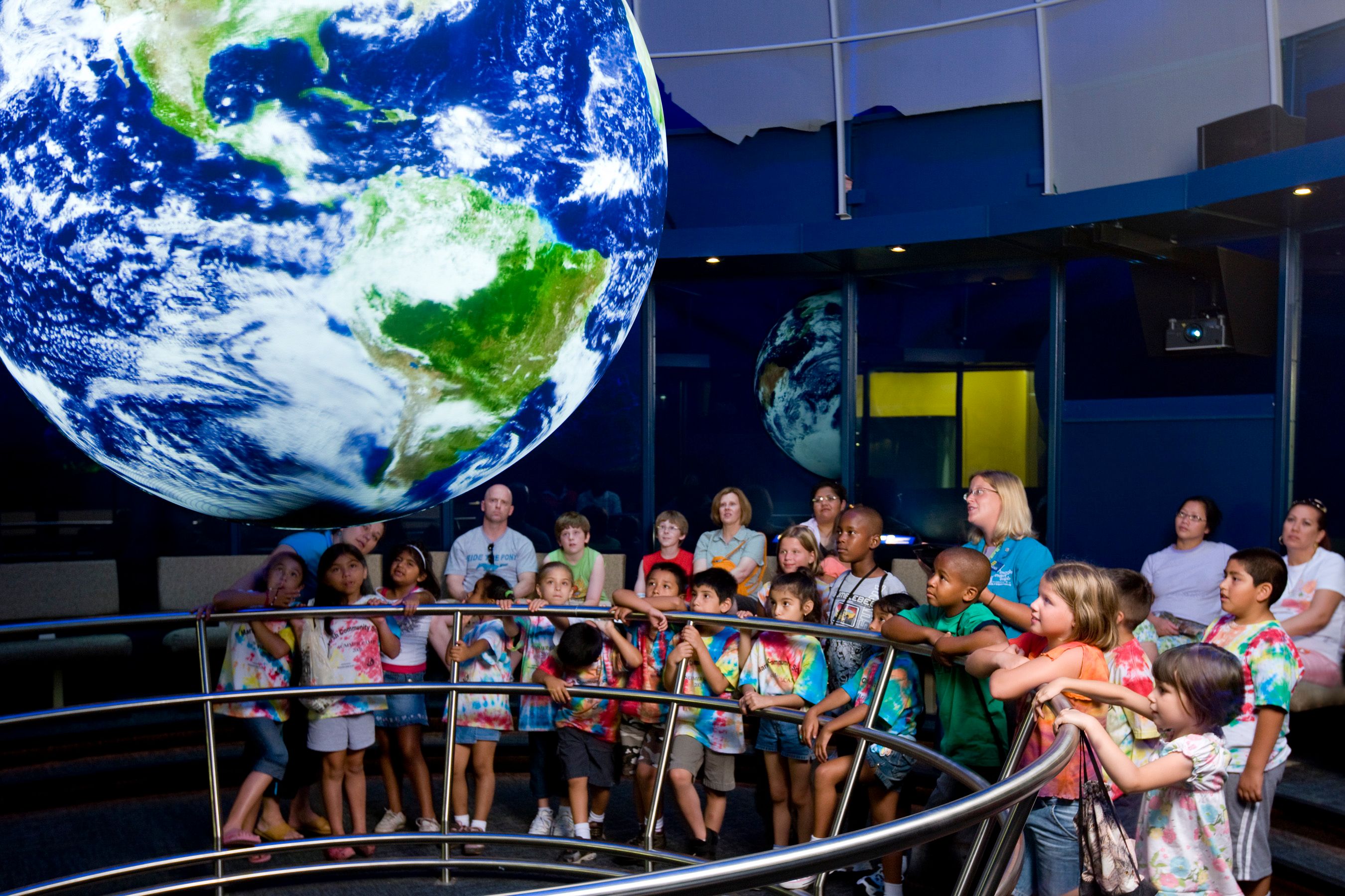
NOAA Science On a Sphere Deployments
- Scientific Visualization
- Global AV Installations
- Custom Middleware
Deployed NOAA’s SOS platform in 20+ countries, integrating real-time satellite, ocean, and climate datasets. Built touchscreen, tablet, and web interfaces for science education and museum use. Worked directly with NOAA/NASA to support initiatives at COP21 and international climate education centers.
Check it out Map of past installs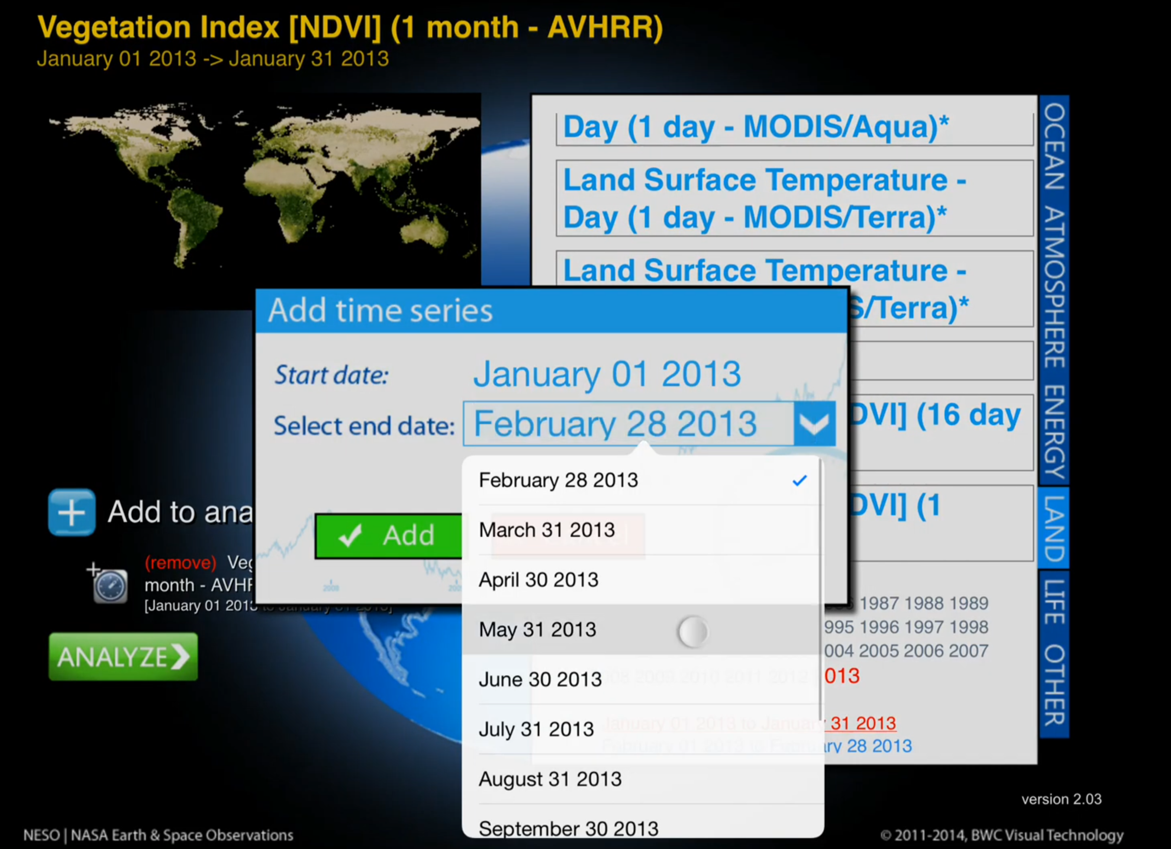
NASA Earth & Space Observations (NESO)
- Remote Sensing + GDAL + MapServer
- OpenLayers, WebSockets, D3
- iPad, Web, and SOS Display Platforms
Led software development and data integration for NESO, an interactive tool for accessing and analyzing NASA remote sensing data. Built a Java-based backend with WebSocket control, dynamic GIS layer rendering using MapServer and GDAL, and D3-powered statistical analysis. NESO ran on NOAA's SOS sphere, web, and iPad platforms and supported educational standards from Common Core to NGSS.
Learn more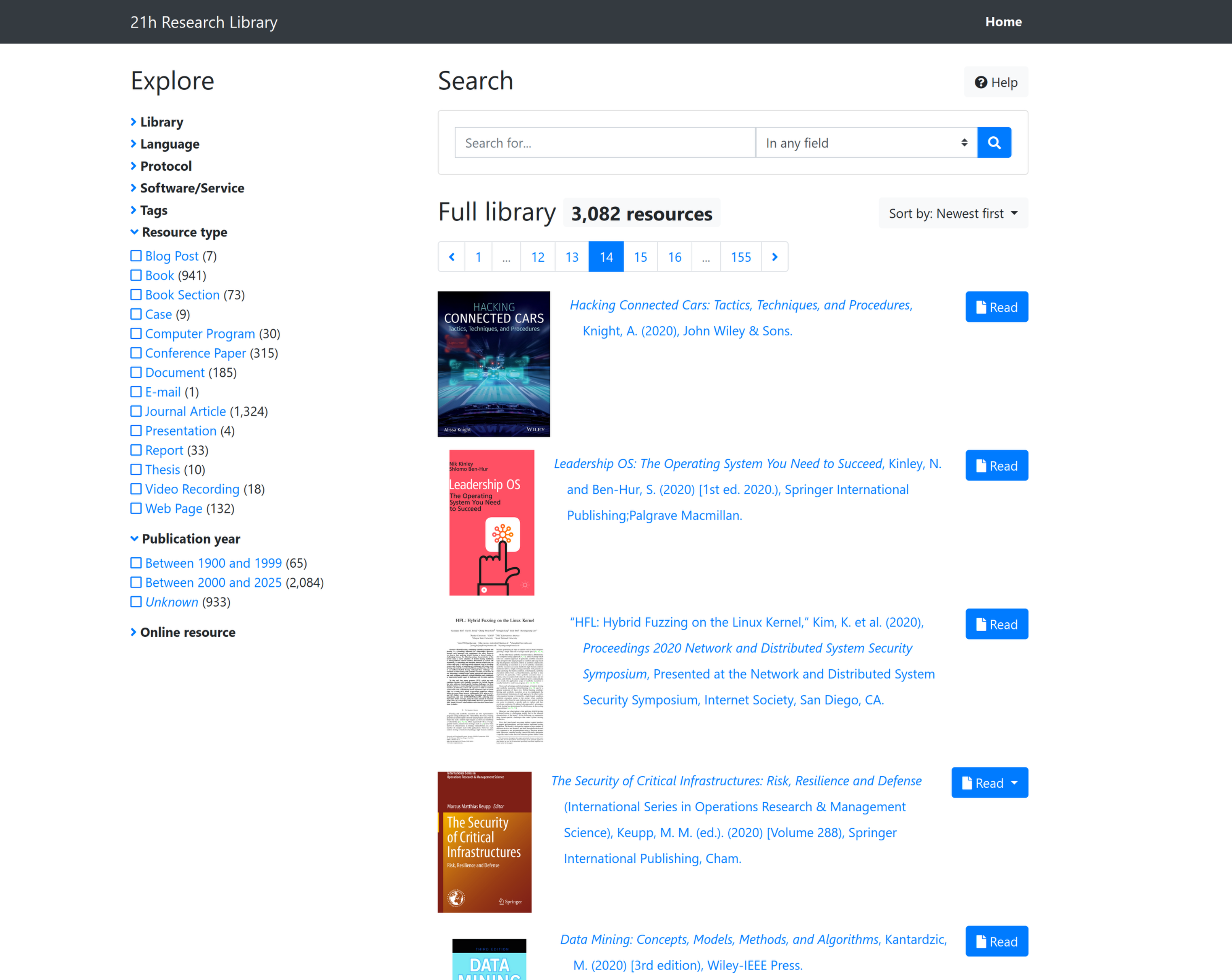
Zotero-Powered Semantic Research Library
- Kerko + Zotero Integration
- Semantic Subdomains
- Role-Aware Research Access
Created a secure, tag-driven research library using Zotero and Kerko for interdisciplinary scholarship in cybersecurity, AI/ML, cognition, and linguistics. Subdomain routing and role-based access control support long-term archival workflows and curated research collections.